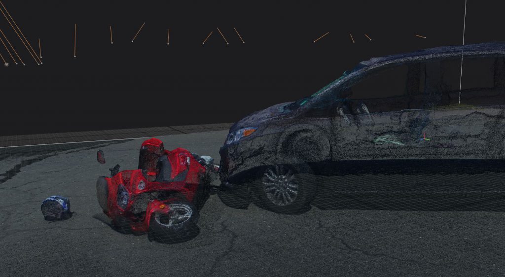
All of us have experienced detours and road closures due to accident investigations lasting several hours. Using forensic photogrammetry, an accident scene can be recreated for later investigative use, allowing for a quicker site cleanup and resumption of road use. We can create detailed crash investigative three dimensional models to show all aspects of the vehicles (damage, location, orientation, etc). Our drones also capture the environmental variables at the scene including uneven roadways, potholes, animal strikes, spills, skid marks and additional details that could be missed during standard scene photography. Millimeter accuracy allows for detailed scene measurement at any point during the investigative process.
We use multiple tools to generate scene models for an additional layer of data acquisition redundancy. This data and these models can be used to locate evidence and aid other forensic analysis to provide a clearer conclusion when determining the events and causes regarding the case.